Current Exhibits and Displays

Our three unique museums offer exhibits that reflect the rich and diverse history of Haldimand County. All museum exhibits are open to the public during regular business hours, free of charge.

Discover our current exhibits and displays below!   

On this page


Current exhibits

All museum exhibits are open to the public during regular business hours, free of charge.

Haldimand County Administration Building front view.

Haldimand County Administration Building

The current exhibit celebrates Haldimand County's long history of Farmers Markets. Farmers markets have been an important part of Haldimand’s agricultural landscape since the 1800s. They serve as vibrant community spaces where people can gather, share ideas and support local businesses. Explore the history of Haldimand’s farmers markets and learn how they have been, and continue to be, cornerstones of community life.

The exhibit will be available for viewing from October - November 2026

Aerial view of Edinburgh Square Heritage and Cultural Centre.

Edinburgh Square Heritage & Cultural Centre

The Edinburgh Square Heritage and Cultural Centre will be closed to the public from April 1, 2026, to approximately March 31, 2027, to support a major accessibility and facility renewal project. No public access will be available during this period.

Check back later for new and exciting exhibitions! 

Front view of Cayuga Library and Heritage Centre.

Heritage Centre

Black History of Haldimand County

Just in time for Emancipation Day, explore Haldimand County's Black History. The Underground Railroad in Canada gave formerly enslaved people from the United States a safe refuge from persecution and opened the door to freedom, allowing many to establish independent lives through land ownership and self-governed Black communities. Learn how North Cayuga Township became an important Black settlement along the Talbot Road for freedom seekers and early Black settlers in Haldimand County. 

When: July 17 - October 13, 2026
Where: Cayuga Library & Heritage Centre, 19 Talbot Street West, Cayuga


Wilson MacDonald Memorial School Museum

The Bee's Knees

Learn about Haldimand in the 1920s with themes of fashion, technology and much more!

When: May - August 2026
Where: Wilson MacDonald Memorial School Museum, 3513 Rainham Road, Selkirk


County Administration Building artifact displays

The Haldimand County Administration Building hosts a selection of local historical artifacts throughout staff areas. 

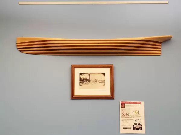
Ship Half Model

Half models were first built by shipwrights as part of the planning process for the design of a ship. Half models were used to confirm the proportion in the completed ship.

Propeller W.T. ROBB, of 355 tons burden was launched at the shipyard of Mr. J. Hardison, at Stromness for Mr. L. McCallum on Thursday, April 30, 1864.

Toronto Globe
Tuesday, May 3, 1864

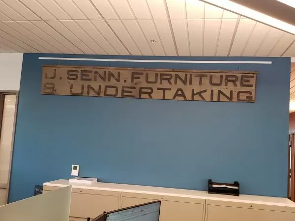
Furniture and Undertaking sign

This historical sign was removed from a Cayuga business located on the site of the present-day Miller Funeral Chapel.

The original building, constructed c. 1881, housed a furniture and undertaking business.

While furniture and undertaking might seem to be an unusual combination, it was quite efficient. Skilled craftspeople, trained in the art of furniture-making, also built coffins as part of their job and, as part of that service, would often provide funeral services, care and attention to the families of the dearly departed.

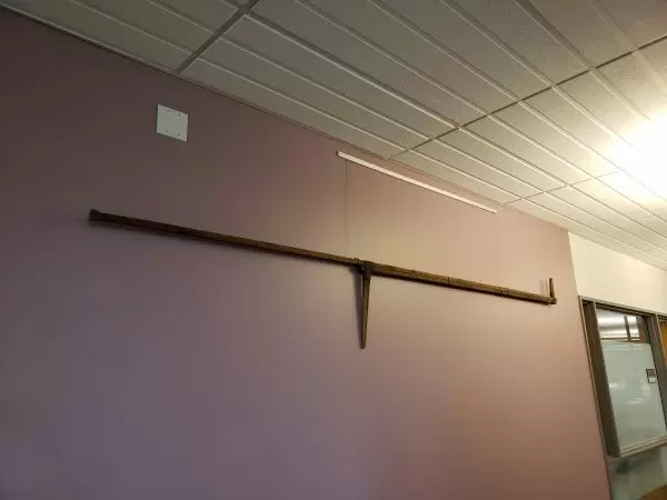
Ice-measuring tool c. late 1800s

Tools like these were used on the Grand River and Lake Erie to measure ice thickness.

Details

  • Handmade, approximately 8 in. in length
  • Age: c. late 1800s

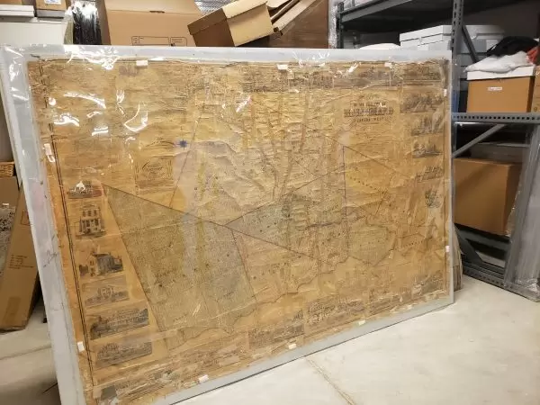
Tremaine map of Haldimand c. 1863

In the 1850s and 1860s, George Tremaine operated a map publishing business in Toronto. He created 54 (known) maps for counties in southern Ontario and Eastern Canada.

A Tremaine Map would include several features such as a survey grid, roads, railroads, towns, buildings and names of rural residents as well as agricultural, cultural and natural features.

Learn more:

Section of former Hamilton-Port Dover Plank road

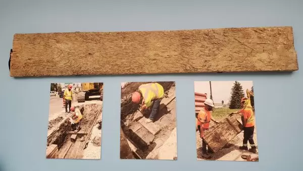
This section of the former Hamilton-Port Dover Plank Road was uncovered on the north side of the Argyle Street railway in North Caledonia on June 14, 2021.

Construction of the Plank Road began in 1839 and was completed in 1843. The planks were hewn from pine, oak, maple, beech and poplar and were up to 3" thick.

Until the early- to mid-1800s, many of Ontario’s roadways were dirt and mud paths. The first half of the 19th century saw a shift to building wooden, or plank, roads which would greatly improve and enhance long-distance and local transportation.

The plank road was a progressive idea; however, like many inventions, new methods of construction were soon favoured for their convenience and cost efficiency. After years of wear, the planks began to warp and rot away. The costs of repair, materials, toll buildings, employees and management soon began to outweigh the initial appeal of plank roads.

To maintain plank roads, ditches had to be dug on either side of the road to drain water and prevent mud from accumulating underneath the planks. Early turnpike companies built these roads and connected bridges with a toll charge to collect funds for road maintenance and police traffic.

The Hamilton and Port Dover Road Company maintained the Grand River Bridge as a toll bridge. Tolls for same-day return for one wagon and two horses was two pence (approximately 6¢), and the toll for pedestrians was one penny. In 1874, the rights to the bridge were vested with Haldimand County, which allocated $22,500 for a new bridge. In 1875, the Toll House was built as a residence for the toll keeper on the east side of the river. The County ceased collecting tolls c. 1890, but the house remained.

The Plank Road acted as a stagecoach route between cities. It was common for these routes to develop transport infrastructure for the safety of passengers and the facilitation of commerce before the development of railways. Taverns and coaching inns were built to serve the needs of travellers and usually included stables. As Caledonia’s population of permanent residents grew, it became necessary to accommodate travellers in stagecoaches, effectively paving the way for more inns and taverns and laying the foundation for future tourism in the area.

In 1851, historian Mr. W.H. Smith, publisher of “Canada: Past Present and Future”, commented:   

Starting from Hamilton by the plank road we enter the district in the township of Seneca and soon reach the flourishing village of Caledonia. No better example could be shown of the advantage of making good common roads (that everybody may travel on) through the Province, that is to be found in the county bordering the plank road from Hamilton to Port Dover; when we first travelled it some five or six years ago. Shortly after the new road was made, the country between Caledonia and Port Dover was a perfect wilderness, scarcely a clearing to be seen, and a stranger would ask with surprise where the traffic was to come from to support the road. Mark the contrast in five short years; nearly every lot along the road has been settled and cleared and fine farms replace the place of dreary forests.

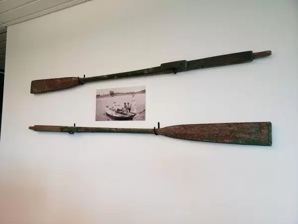
Rowboat oars from late 1800s

Rowboat oars from around the late 1800s. 

Traffic signal from 1940s

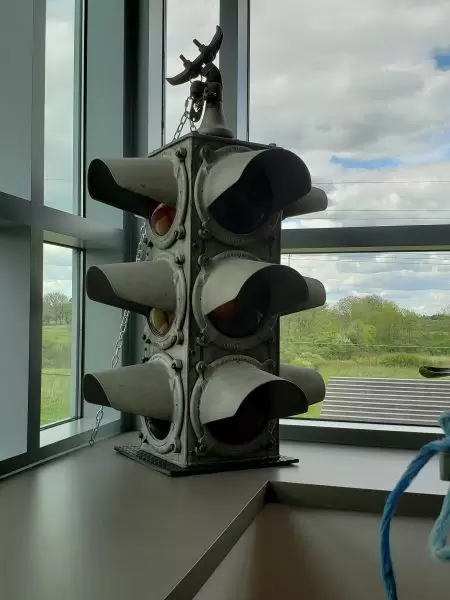
Located at the corner of Cayuga Street and Hwy. 3, this was once Cayuga’s only traffic light and was in use until the 1950s.

Manufactured by W.S. Darley & Co., this is a 3-Bulb, 4-Way Traffic Signal. The amber lens reads “CAUTION”.

Painting of Mohawk Island Lighthouse

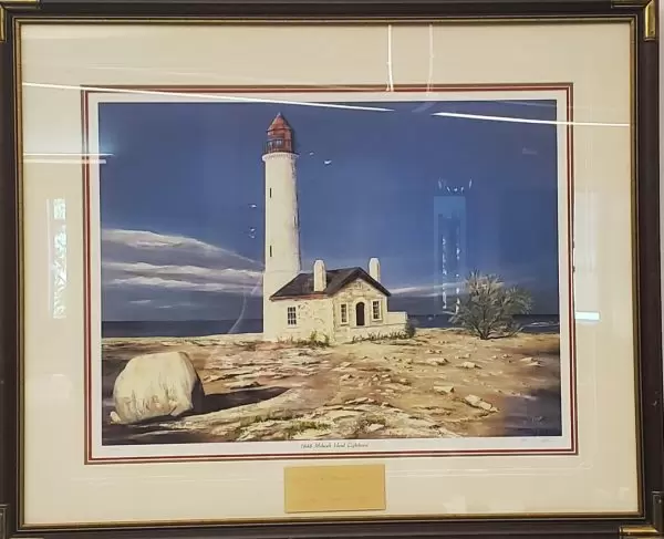
The painting depicts the historical Mohawk Island Lighthouse as it was in 1848.

Located on Mohawk Island near Rock Point Provincial Park at the eastern end of Lake Erie, and close to nearby Dunnville, the Mohawk Island Lighthouse was designated by the Historical Sites and Monuments Board of Canada in May 2015.

From the Parks Canada Directory of Federal Heritage:

The Mohawk Island Lighthouse is a lighthouse in ruins that stood originally as an 18-metre (59-foot) tall stone, cylindrical, tapered tower with an integrated, rectangular lighthouse keeper’s residence. Built in 1846-8, the lighthouse is lacking some of its original features, including the lantern and roofs for the tower and dwelling. 

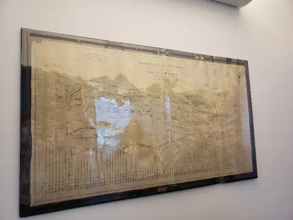
Map of proposed new location of River Road

Plan and Distance of Proposed New Location of River Road
In the River Range
Township of Tuscarora
Six Nations Roads 1932

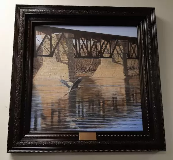
Painting titled Cayuga Train Bridge

Painting titled Cayuga Train Bridge by artist Billy-Jack Milligan.

The painting was presented by Kathy and Billy-Jack Milligan to Haldimand County to commemorate Cayuga’s 150th Anniversary.

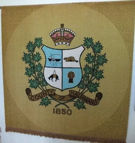
Section of carpet showing Haldimand County 1850 Coat of Arms

This section of carpet was originally installed in the Haldimand County Council Chambers, 45 Munsee Street North, Cayuga, around 1968; the carpet remained in place until the inception of the Regional Government in 1974. A second carpet hung inside the Treasurer’s office.

Haldimand County Coat of Arms:
Many of the elements featured in the 1850 Coat of Arms are reflected or redefined in the new Haldimand County Coat of Arms, created in 2001.

Crown
The Royal Crown is a symbol of government.

Shield
The shield is the central element to the coat of arms representing unity and working together in harmony. The shield is a central element upon which the symbols of identification are fixed. This design is mirrored in the 2001 version of Haldimand County’s coat of arms.

The Shield reflects four themes:

Colours
The dominant colours—gold, burgundy, blue and green—symbolize the riches of the land, the waters that replenish it and the people who call this area home. The same colours are also used in the new Haldimand County logo.

Sheaf
Represents the rich farmlands and bountiful agricultural produce (grain, fruit, vegetables, livestock) extending far into Haldimand’s past.

Riverboat
Represents early water transportation along the Grand River, which is a significant part of Haldimand’s history.

Water
Water is represented by the striped-line background of the first and fourth quadrants. Both the Grand River and Lake Erie have been important to farming, industry, commercial fishing and recreation throughout Haldimand’s history.

Donkey
Represents industries and the labour of the people; the donkey symbolizes the industrial development of the gypsum mining industry in Haldimand, which provided many individuals with employment.

Leaf
The Leaf represents the Carolinian forests—which give Haldimand County its character—and the bygone lumber industry.
The maple leaf is a symbol of Canada, representing the hardwood trees which are prominent in this area.

Beaver
Symbolizes creativity, creation, cooperation, persistence and harmony.